
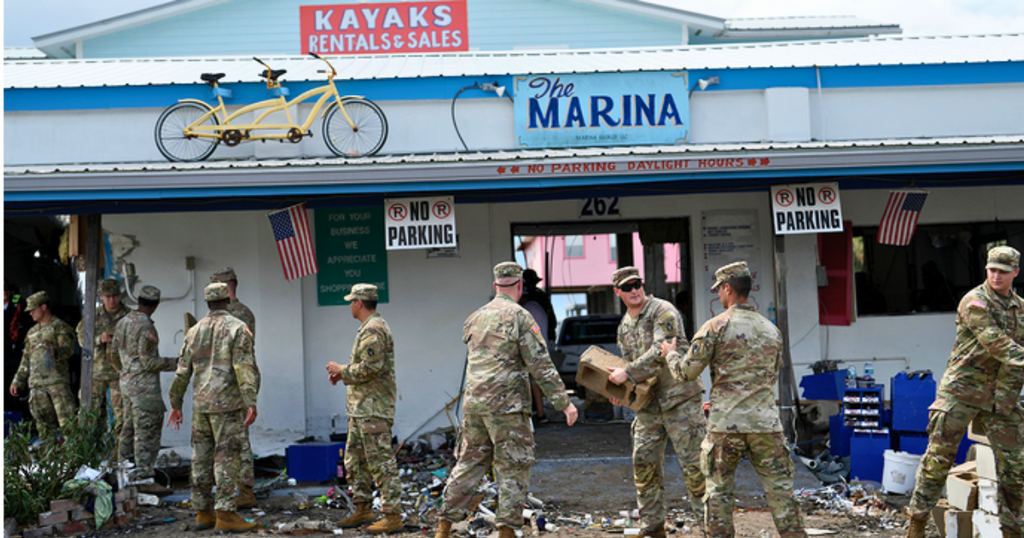
Hurricane Isaias threatens the Gulf Coast as powerful winds, dangerous storm surge, flooding rain and possible tornadoes raise urgent concerns ahead of landfall.
Hurricane Isaias Threatens Gulf Coast With Dangerous Landfall as residents prepare for powerful winds, life-threatening coastal flooding and torrential rain ahead of the storm’s expected arrival.
Hurricane Isaias strengthened over the Gulf of Mexico on Friday, October 9, 2026, prompting urgent preparations across the northern Gulf Coast. Forecasters warned that the storm could briefly reach major hurricane strength before approaching land later Friday or early Saturday.
The dangerous system threatens coastal communities across Mississippi, Alabama and Florida’s Panhandle. Officials urged residents to follow evacuation orders and complete preparations before worsening weather limits safe movement.
Hurricane Isaias Strengthens Ahead of Gulf Coast Landfall
Isaias continued moving north-northeast across the Gulf of Mexico as meteorologists tracked its changing intensity and projected path. An early Friday advisory reported maximum sustained winds of 110 mph, placing the storm near Category 3 hurricane strength.
Forecasters expected Isaias to approach the northern Gulf Coast on Friday night, with landfall possible within the designated hurricane warning area. Although wind speeds could decrease before landfall, officials warned that dangerous conditions would remain.
The storm’s projected path places several coastal communities at risk of destructive winds, flooding and hazardous coastal conditions. Residents should monitor official forecasts because even modest changes in the track could alter local impacts.
Dangerous Storm Surge Threatens Coastal Communities
Flooding Could Become Life-Threatening
Storm surge presents one of the most serious threats as Isaias approaches the shoreline. Forecasts indicated that water could rise several feet above normally dry ground, particularly along exposed stretches of the Alabama coast and Florida Panhandle.
Officials warned that rising water could inundate roads, neighborhoods and low-lying coastal areas. Strong onshore winds and high tides could worsen flooding, leaving some evacuation routes unsafe.
Residents in vulnerable locations should follow local evacuation instructions rather than wait for water to approach their homes. Driving through flooded roads can put lives at risk.
Heavy Rain Could Trigger Flash Flooding
Isaias could also deliver widespread rainfall across the southeastern United States. Forecasts called for four to eight inches across southern Alabama, Florida’s Panhandle and Big Bend, and southwestern Georgia.
Some locations could receive as much as 15 inches, increasing the risk of flash flooding and significant river rises. Heavy rainfall may continue after the hurricane moves inland, extending dangerous conditions into the weekend.
Hurricane Warnings Cover Parts of the Gulf Coast
Authorities issued hurricane warnings for coastal areas extending from Ocean Springs, Mississippi, to the Bay and Gulf County line in Florida. Tropical storm warnings covered additional stretches of the northern Gulf Coast.
A storm surge warning also highlighted the danger of coastal inundation from the Mississippi River mouth toward Florida’s Suwannee River. Officials encouraged residents to complete protective measures before hurricane conditions arrive.
Emergency agencies continued monitoring the storm while communities prepared shelters and reviewed evacuation arrangements. Residents should rely on local emergency management officials for location-specific instructions and updated warning information.
Tornado Threat Could Continue After Landfall
Hurricanes can produce tornadoes within their outer rainbands, adding another danger beyond destructive winds and flooding. Forecasters identified a tornado risk across coastal Alabama, Florida’s Panhandle and far southwestern Georgia beginning Friday evening.
The threat could continue Saturday across parts of eastern Alabama, Georgia and the Florida Panhandle. Residents should keep weather alerts enabled and identify a safe interior room away from windows.
As Isaias moves inland, weakening winds will not necessarily eliminate the risk of severe weather. Heavy rainfall, isolated tornadoes and localized flooding could continue affecting communities throughout the weekend.
What Residents Should Do Before Isaias Arrives
People living within warning areas should prioritize safety and follow instructions from local authorities. Preparing early can reduce exposure to dangerous conditions when roads become flooded or winds intensify.
- Follow evacuation orders and move to designated shelters when officials direct you.
- Keep drinking water, essential medicines, food and emergency supplies ready.
- Charge mobile phones and portable power banks before power outages begin.
- Avoid flooded roads, coastal areas and unnecessary travel during severe weather.
- Monitor official weather alerts for changes in warnings, rainfall forecasts and evacuation guidance.
Gulf Coast Braces for a Dangerous Night
Hurricane Isaias threatens the northern Gulf Coast with a combination of damaging winds, storm surge, heavy rainfall and possible tornadoes. Its precise impacts will depend on the final track, storm intensity and local conditions.
Even if Isaias weakens before landfall, coastal flooding and inland rainfall could cause significant disruption. Residents should remain alert through the weekend and prioritize official safety guidance as conditions evolve.
Also read: Guinness Brewery Closing in US as Diageo Cuts Costs